Listing media
Aerial photography and drone video for Long Island listings
Aerial photography shows what a listing looks like from above: the shape of the lot, how close the water is, the roof and the grounds, and how you arrive. Core Media Co., a video production studio in Saint James, NY, flies listings across Long Island when wind, rain, and airspace near an airport do not rule out the day. Drone is included from Photos + Air, $495 per listing, and on every package above it. On the packages with a listing video, the aerial footage is cut into the video as well.
From above
What aerials show
Some of what a buyer is paying for cannot be seen from the ground. Aerials show it.
- The lot: its shape and depth, the tree line, and how the house sits on it. An aerial is not a survey, so where the lot lines fall is a question for the survey, not the photo.
- The water: how close the harbor, the bay, the Sound, or the beach actually is, and which way the view looks.
- The roof and the grounds: the roofline, the pool, the patio, the gardens, the outbuildings, and the drive.
- The approach: the road in, the driveway, and how the house presents as you arrive.
Flight rules
Airspace and weather
Wind, rain, and some airspace near airports can limit when and where a drone can fly, and some days and some addresses are not flyable. We would rather say so up front than leave you guessing.
- Airspace: some areas near airports can limit where a drone can fly, and a few spots cannot be flown at all. Long Island has several airports and airfields, so we tell you before the shoot if a location is affected.
- If the airspace rules out a flight at an address, we tell you before the shoot day.
- Weather: wind and rain cancel flights. When the forecast rules one out, we tell you as early as we can and agree when to fly instead.
- Takeoff: some parks, beaches, and villages restrict where a drone can take off, and we plan the flight around them.
Delivery
What is delivered
- Aerial photos, finished and MLS ready, in the same shared folder as the ground photos.
- On the Full Package and Signature, aerial footage cut into the listing video, in the horizontal master and the vertical cuts for Reels and Shorts.
- Full resolution files alongside the sized ones, and one round of revisions.
- Full ownership of the finished work.
Recent work
Examples
From the Recent Work gallery. Addresses, agents, and clients are withheld.
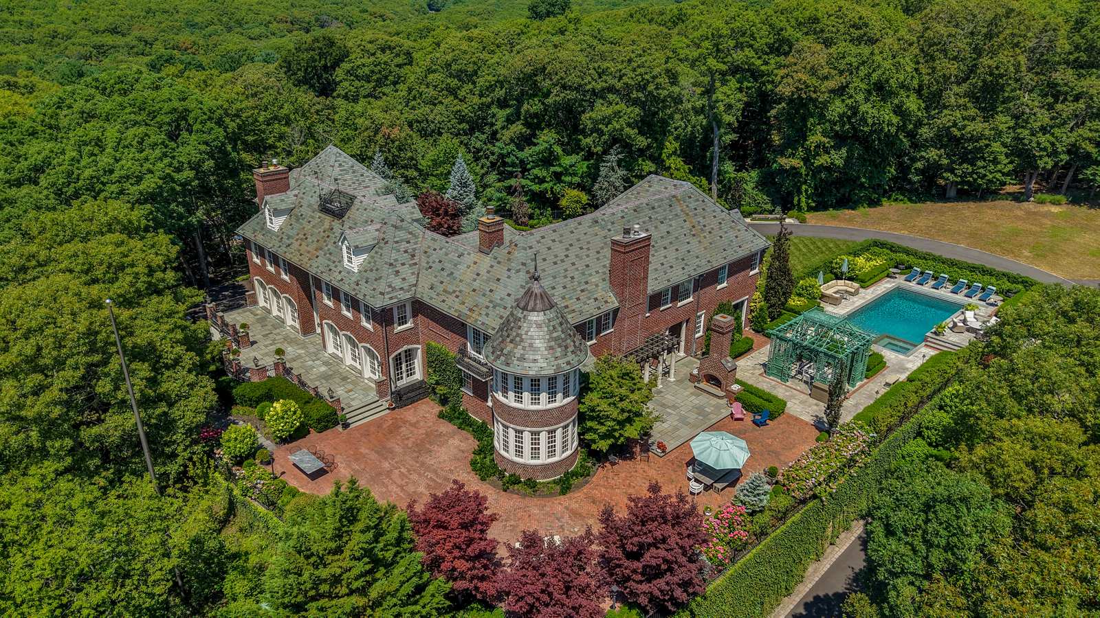
Aerial, Suffolk County, NY 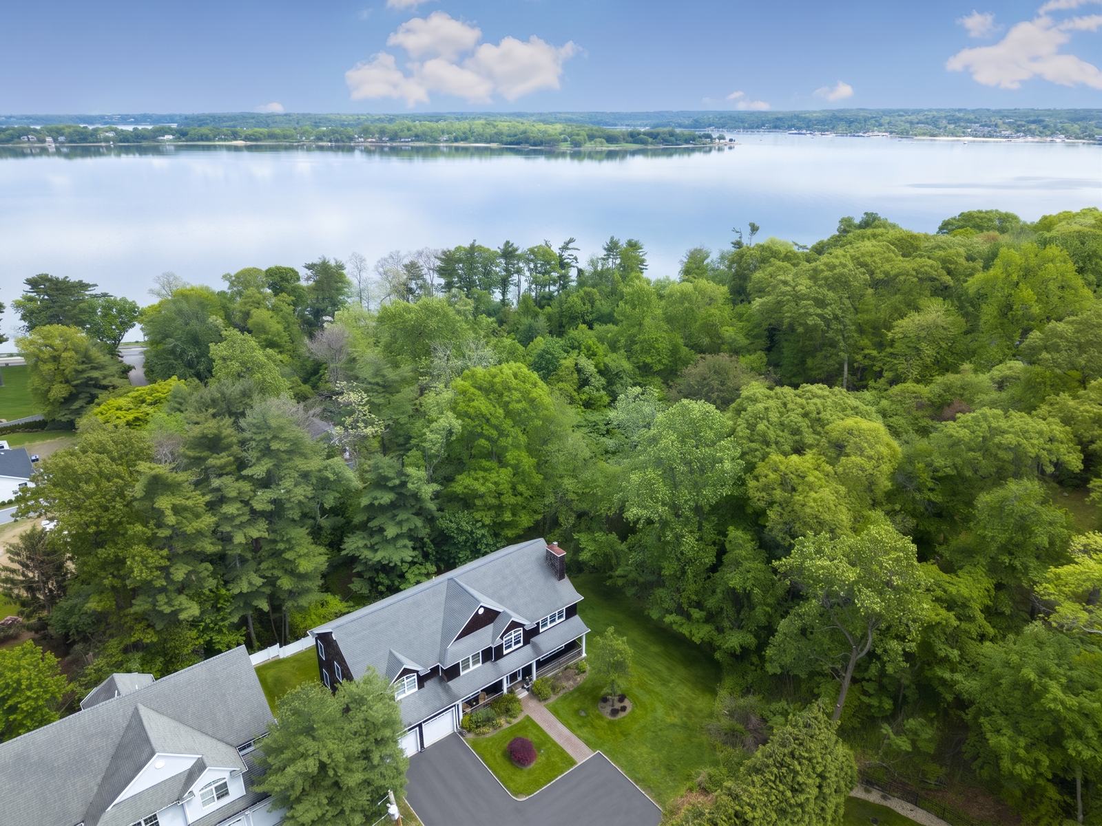
Aerial, Nassau County, NY
Per listing
Which packages include aerials
Drone is part of three listing packages, each priced per listing: Photos + Air, the Full Package, and Signature. The monthly plans for agents cover the Full Package on each listing, drone included, with a 3-month minimum.
Photos + Air
$495per listing- Professional photos, MLS ready
- 2D floor plan
- Drone
Full Package
$695per listing- Professional photos, MLS ready
- 2D floor plan
- Drone
- Listing video
Signature
$1,250per listing- Everything in the Full Package
- Twilight
- A full property tour of roughly 10 minutes
- Social clips pulled from the tour
| Package | What is included | Price |
|---|---|---|
| Photos + Air |
| $495per listing |
| Full Package |
| $695per listing |
| Signature |
| $1,250per listing |
One round of revisions included on every package. You own the finished work, with no usage restrictions.
See every listing package on the pricing pageWhat real estate video costs on Long Island
Questions
Questions we get about aerials
- Do I need drone photos for my listing on Long Island?
- Not for every listing. Aerials earn their place when the lot, the water, the roofline, or the grounds are part of what a buyer is paying for, or when the house sits back from the road and the ground photos cannot show the setting. For a house on a standard lot where everything is visible from the street, the ground photos cover most of it.
- How much does real estate drone photography cost on Long Island?
- Drone is included from Photos + Air, $495 per listing, and on every package above it. Photos + Air includes professional photos, a 2D floor plan, and drone. The Full Package adds a listing video at $695, and Signature is $1,250. The price is the same in every town we work in.
- Can you fly a drone near an airport on Long Island?
- Sometimes. Airspace near some airports can limit where a drone can fly, and a few spots cannot be flown at all. We tell you before the shoot if a location is affected.
- What happens to the drone shoot if it is windy or raining?
- We do not fly in rain, or in wind the aircraft cannot hold steady in. If the weather rules out the aerials on the shoot day, we tell you as early as we can and agree when to fly instead.
- Do aerial photos show the property lines?
- They show the lot, the tree line, and how the house sits on the land, but an aerial is not a survey and should not be used to show where a property ends. For the lot lines, the survey is the source.
Keep reading
- Twilight photographyTwilight photography for Long Island listings
- Floor plansFloor plans for Long Island listings
- Listing mediaAll five listing packages, what each includes, and how a shoot runs from booking to delivery.
- PricingEvery package and plan in one place, with the minimums stated.
- What real estate video costs on Long IslandThe real numbers, and what moves a listing from one package to the next.
- What a listing shoot includesPrep, the shoot, the edit, and what lands in the shared folder.
- How to prepare a home for listing photosA room by room checklist to forward to a seller before the shoot.
Book a call
Book a 20-minute call.
Tell us what you are trying to do. If it is a fit, we send an agreement and pick a date.
Prefer to write? Send us a note at studio@thecoremedia.co
Saint James, NY 11780studio@thecoremedia.co
Based in Saint James. Working across Smithtown, Huntington, Port Jefferson, and all of Suffolk and Nassau County.